
Polarstern Reaches Sailing Milestone
Polarstern Reaches Sailing Milestone
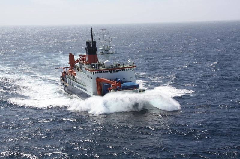
Polarstern in open Water (Photo: Alfred Wegener Institute / Folke Mehrtens)
On 26 August 2026, the German research icebreaker Polarstern reached the milestone of covering two million nautical miles since it entered service on 9 December 1982.
The distance covered – a total of two million nautical miles – is equivalent to around 3.7 million kilometers, which is just over 92 circumnavigations of the Earth at the equator. And that is roughly ten times the distance from the Earth to the Moon (360,000 to 410,000 kilometers, depending on the elliptical orbit).
It remains to be seen, however, just how many more miles the Polarstern will cover still. With over 40 years of service under its belt, it remains a reliable research platform thanks to careful and prudent operation, while maintenance and operating costs, as well as new requirements, mean that a successor vessel is set to replace it in 2030.
On board, the ship’s crew of around 40 people supports up to 55 researchers investigating processes ranging from the seabed through the water column and all the way through to sea ice and up to the atmosphere.
When grabs or corers extract sediments from the seabed, or the water sampler brings liters of water from depths of hundreds of meters up onto the deck, the crew positions the Polarstern as close as possible to a scientifically particularly relevant and exciting location. The deployment of equipment such as the OFOBS (‘Ocean Floor Observation and Bathymetry System’) camera and sonar system calls for a little more maneuvering; the Polarstern tows this system at low speed just a few meters above the seabed – and has, for example, discovered millions of fish nests in Antarctica.
At present, the flagship vessel of the Alfred Wegener Institute, Helmholtz Centre for Polar and Marine Research (AWI), is conducting research about the geology of the Arctic Ocean. Sedimentary deposits on the seabed, several hundred meters thick and extending down to the oceanic crust, are being mapped by way of geophysical methods and sampled with the help of core-sampling equipment.
Related Stories
 Technology
Rwanda and ST Engineering explore technology solutions for urban development
4 hours ago
 Technology
Ministry of SMEs and Startups to Inspect 15,000 Entrusting and Entrusted Companies for Unfair Trade Practices
5 hours ago
 Technology
Three takeaways from Elon Musk's latest political donations
8 hours ago
 Technology
Body of missing man found in Okanagan Lake after 23 days
10 hours ago
 Technology
QNX Launchpad Introduced to Help Startups Build and Scale Mission
10 hours ago
 Technology
Texas Tech Faces Arizona State With Five Players Out For Big 12 Clash
12 hours ago
 Technology
PU to help startups land first business orders
13 hours ago
 Technology
NetApp Selects Five Deep
14 hours ago