How volunteer map makers save lives in a disaster
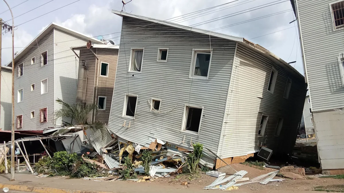
In parts of Venezuela devastated by last month's earthquake, destruction is so severe that navigating and finding survivors can be a challenge.
Emergency workers have been searching through the rubble of collapsed homes and workplaces after the 24 June earthquake, which killed more than 2,000 people.
Helping them navigate the destruction is MapAction, a charity founded in Great Missenden, Buckinghamshire, in 1994 and now based in Chinnor, Oxfordshire.
Since its first emergency response in 2002, the organisation has attended more than 150 disasters, providing what it describes as a "satnav for humanitarians".
Its teams have supported responses to crises around the world, including the 2004 tsunami in Sri Lanka and flooding in the UK in 2006.
Earlier this year the charity assisted after a cyclone in Madagascar and floods in Mozambique.
Chief executive Darren Dovey said co-ordination was vital in the aftermath of a major disaster.
He said: "A lot of different international agencies and local agencies are doing what they can to try to help - and all of that needs co-ordination, that's where MapAction come in.
"What you don't want is people searching the same areas, and we're able to provide that information to say what's been searched, and what still needs to be searched."
There are two Spanish-speaking specialists from the volunteer-driven group currently working on the ground in Venezuela.
Jorge Andres and Harry Mathchette-Downes are based at Forum La Guaira Stadium, alongside other responders and co-ordinators.
Within their first week the pair helped produce 20 real-time maps to guide response teams.
Since 2002 the charity has responded to 20 earthquake incidents.
Because of the time difference, while the team in Venezuela is working in the field, a team of more than 70 volunteers in the UK and Europe work through the night to process incoming data.
If the data is available, mappers can provide details down to the street level, identifying specific housing blocks where people are most likely to be trapped.
Dovey said: "Generally people will know who should have been in a building at any one particular point in time.
"All of that information will be collected from the ground up and then it will be made available.
"We'll also be responsive to the needs of those other rescue agencies that are on the ground, which is why we actually deploy people into country."
The maps are used not only by search and rescue teams, but also to show which medical centres, airports and roads remain open.
When hurricanes strike, the charity helps identify temporary shelters away from the path of the storm where people can get food, water and medicine.
A report by the Council on Foreign Relations has found that funding for humanitarian work has dropped since 2025.
Dovey emphasised that because the information they provide "absolutely does save lives," it is important donors support the charity's work.
He said: "We need to keep the operation running so that we can keep those volunteers available effectively and we can be ready to deploy anywhere.
"When people think about that relatively small charity doing this type of work... it's vitally important that we keep it going."
Finding the 'invisible' millions who are not on maps
Related Stories
 Community
New accessible dock launches at Thunder Bay’s Boulevard Lake
5 days ago
 Community
Community fair held to encourage Toronto’s residents to vote
5 days ago
 Community
Wainwright community grapples with aftermath of military base disaster
5 days ago
 Community
Dawson Creek voters embrace Dwaine Dilworth as their newly elected mayor
5 days ago
 Community
'Looking for a change': Fort Nelson mayor eager for B.C. election
5 days ago
 Community
Calm space garden needs younger helpers to survive
6 days ago
 Community
Israel-Lebanon agreement shines light on long
6 days ago
 Community
As the new film hits theaters, we rank Street Fighter's LGBTQ+ characters
1 week ago